This part of Nakasendo trail starts from Magome-juku, to Ochiai-juku and then to Nakatsugawa -juku via the stone pavement of Ochiai, which retains the taste of the old Nakasendo. The trail between Tsumago-juku and Magome-juku is very famous and many people walk. Trail from Magome-juku to Nakatsugawa-juku is less popular but you can enjoy a quiet hike from.
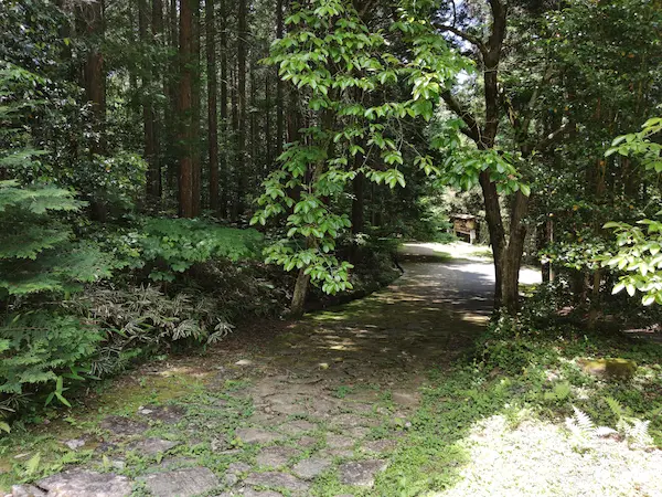
Except for the stone-paved part of Ochiai, entire part is a paved road, but it is not an arterial road and there are not many cars.
Click here for a map of this trail。
Same article appear on Nakasendo guide Website as well.
Course highlights
You can take a bus from JR Nakatsugawa Station to Magome, but depending on the day and time, there is only one bus per hour, so be careful ( check Google Map from Nakatsugawa Station to Magome ).
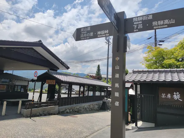
Once you get off the bus at Magome, follow the signposts at the corner of the entrance to Magome-juku and go down the slope. The color of the pavement on the road to Nakatsugawa is unique, so it’s not easy to make a mistake on the route.
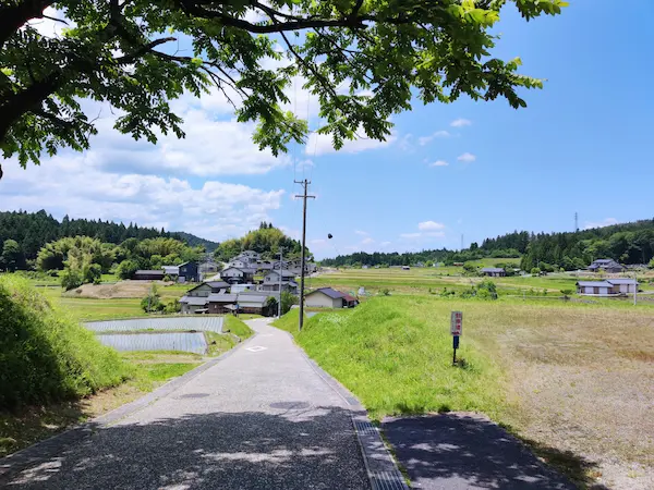
Rural scenery as soon as you start descending. This kind of scenery continues for a while.
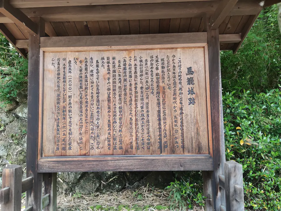
After going down for a while, you will see the information board for the Magome Castle Ruins. It is said that the castle has been around since the Muromachi period. It was the residence of Yoshimasa Kiso who turned over to Hideyoshi Toyotomi during the Battle of Komaki and Nagakute.
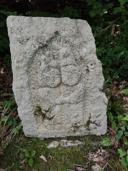
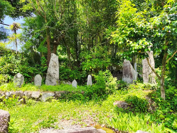
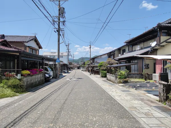
Following the road, you will find historical monuments here and there. There were several old folk houses provided as guesthouses along the way.
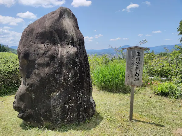
The monument of Shiki Masaoka is in the place where the view is open . It seems that he passed through this area in 1891 .
Eventually, the famous “Koko yori Kita Kisoji” (“Kisoji starts here to the north”) monument. This was once the border between Mino and Shinano. Now that Magome has been incorporated into Nakatsugawa City, both sides are in Gifu Prefecture (Mino).
Nearby is an Ichirizuka (mound constructed every 4 km) in Shinchaya. The east side is the original mound, and the west side is restored one.
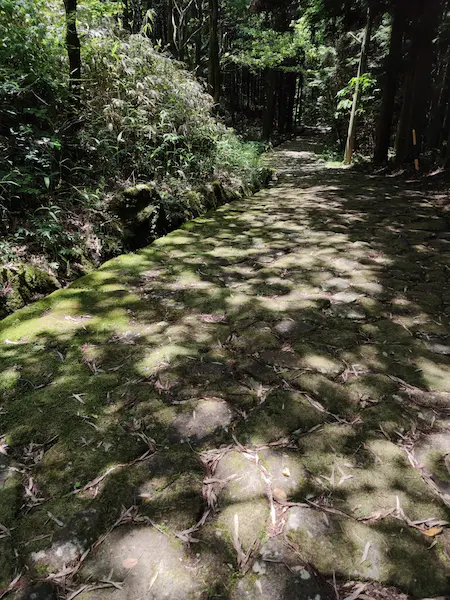
Stone-paved road in Ochiai
Only pedestrians can pass the stone-paved road in Ochiai. Moss-covered flat stones continue under the dim tree. Some sections have remained since that time, and the rest have been restored. Ochiai stone pavement is said to have been set up by the Owari-han, which had jurisdiction over this area during the Edo period, to protect the slopes and make it easier to walk.

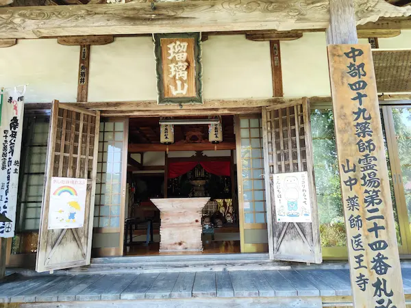
When the road goes out to a small village, there is a temple called Iouji, also known as Yamanaka Yakushi. The origin of temple is very old and unknown. It is said that a famous Buddhist Monk Gyoki carved and worshiped Yakushi Nyorai (Bhaisajyaguru) in the Nara period. There is a weeping cherry tree in the precincts, which is the replacement of the first one collapsed due to a typhoon. The original one was said to be planted by Yoshinaka Kiso (Minamoto no Yoshinaka), a famous Samurai in Heian Period.

Nakasendo crosses the bridge over the Ochiai River. There is a check dam just upstream and it is quite scenic.
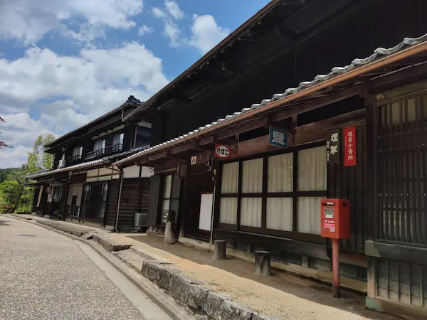
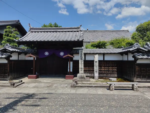
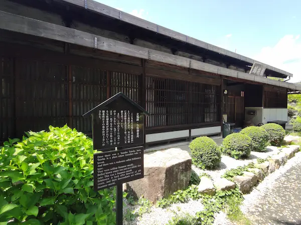
Ochiai-juku
Ochiai-juku retains the remnants of what it used to be, with some old buildings remaining. It has not been converted into a tourist destination, and it is not as busy as Magome-juku.
The existing Honjin (inn for high ranking people) of Ochiai-juku was built in 1818, and it is very valuable that the headquarters of the Edo period remains. However, the museum is open only on limited Sundays.
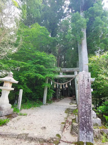
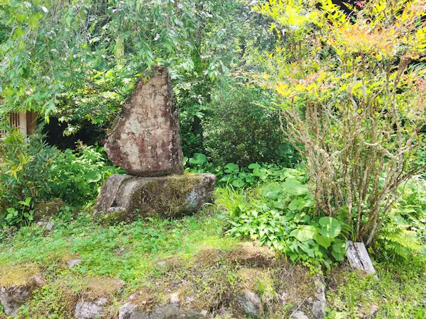
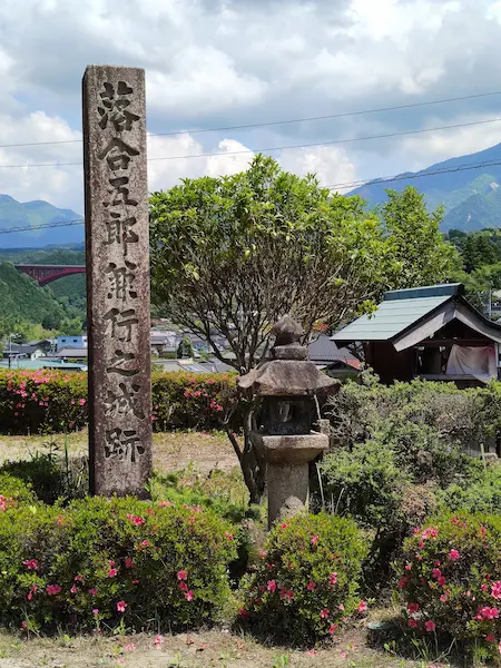
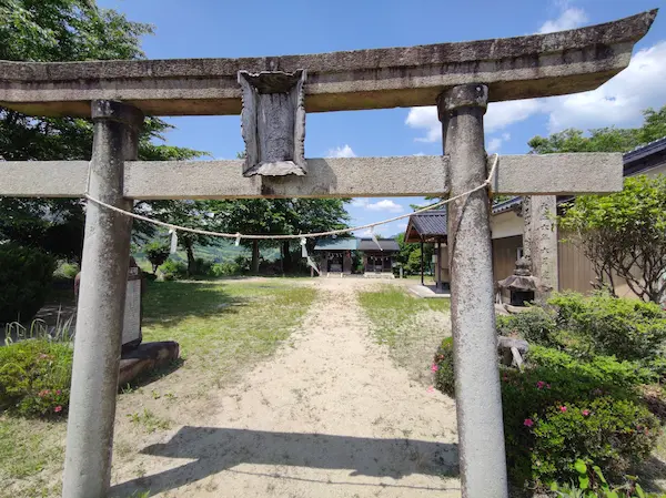
After leaving Ochiai-juku, Nakasendo will cross National Highway 19 at the viaduct. Immediately ahead is the torii gate of the shrine that says “Ogaran Shisha”. “Ogaran” seems to come from “garan”, large buildings. It is said that there was a castle building of Goro Ochiai, who was a senior vassal of Yoshinaka Kiso, around here. However, nothing was found during the excavation, and there is a monument of “Castle Ruins of Goro Ochiai” standing in the place estimated from old literature.
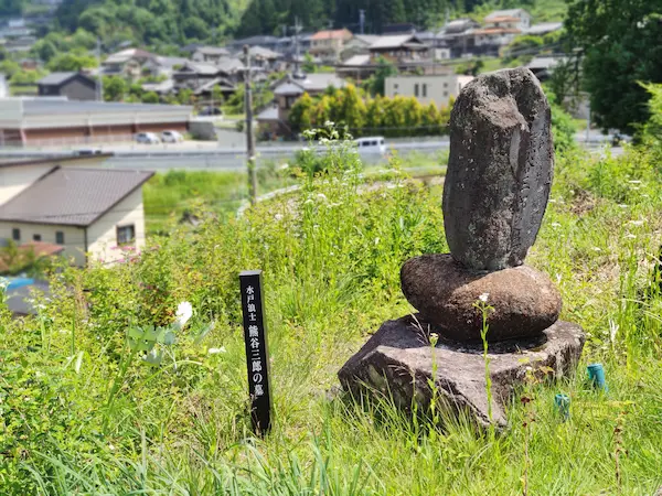
As I walked down the road, there was a sign saying “Tomb of Saburo Kumagai, a ronin of Mito”. Saburo Kumagai, who joined the Tengu Party, which was set up with the aim of becoming a rebellion, stayed at Ochiai-juku in 1864 aiming for Kyoto. But he was beheaded by his colleagues for violating the discipline of the party. Villagers who pitied it buried him here. It doesn’t seem to be a person who has made a special achievement or a celebrity. Still, the tombstones tells a story of Japanese history.
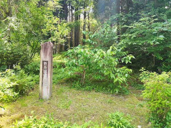
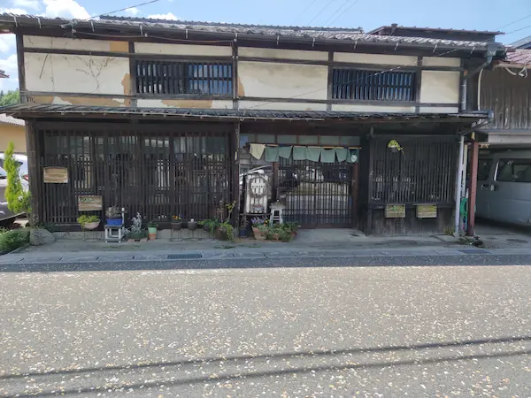
Nakasendo crosses National Highway 19 again. The road is uphill from here. I thought that the downhill would continue from Ochiai-juku to Nakatsugawa-juku, but in reality there are quite a few undulations. If you walk along the landscape with rice terraces, you will find a teahouse Echizenya. This is the trace of Yosaka Check Post. The post is like a barrier set up by the Owari-han to control the outflow of the Five Sacred Trees of Kiso. The teahouse here was famous for “Yosaka’s Sanmonmochi”, which is a sweet made from rice flour, and is still open as a coffee shop using an old folk house.
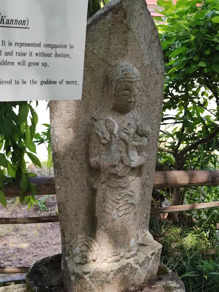
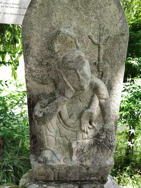
Then a down hill road from this point. Kono Bato Kannon (Hayagriva) stands by a road side. Hayagriva is often seen along old highways.
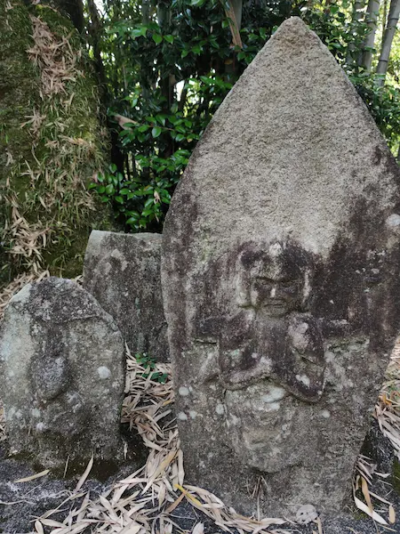
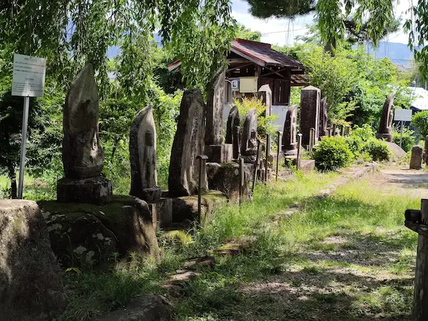
Next is the Jizo-do stone Buddha group in Kono. It is said that the stone Buddhas along the highway in the Edo period are summarized here. The location of Jizo-do itself, which was once said to have been in this area, has become unknown.
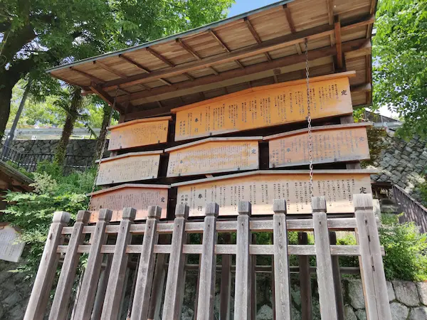
If you go down a steep slope, you will find Nakatsugawa-juku’s kosatsuba, public bulletin board in Edo Period. We are already in a part of the Nakatsugawa city area.
The Nakasendo that passes through Nakatsugawa-juku goes through the city of Nakatsugawa. We turn north at the intersection, and JR Nakatsugawa Station is just around the corner.
Meeting points
Nagoya Station, Nakatsugawa Station and nearby places.
Course time
This course starts from Magome-juku and takes about 4 hours. Except for Ochiai’s stone-pavement, we walk on all paved roads.
Lunch
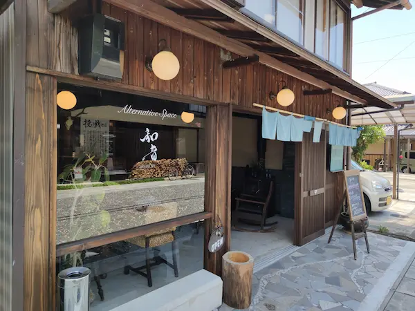
You can have lunch at Ochiai-juku. Photos show a place called Alternative Space Waon.

Toilet
There are several public toilets along the way.
What to bring and what to wear
It’s okay to wear clothes for walking around town. Hiking shoes are recommended as the cobblestones can be slippery.
Hiking time
You can visit it all year round, but it’s best to avoid it when it’s snowing.
Highlights of the neighborhood
If you have good legs, you can walk from Tsumago-juku to Nakatsugawa station via Magome-juku in one day. See this page.
If you arrive at Nakatsugawa Station early, you can also make a round trip to the Ruin of Naegi Castle.
If you are interested in this course, please contact us from here.